Friday June 13

The skies are
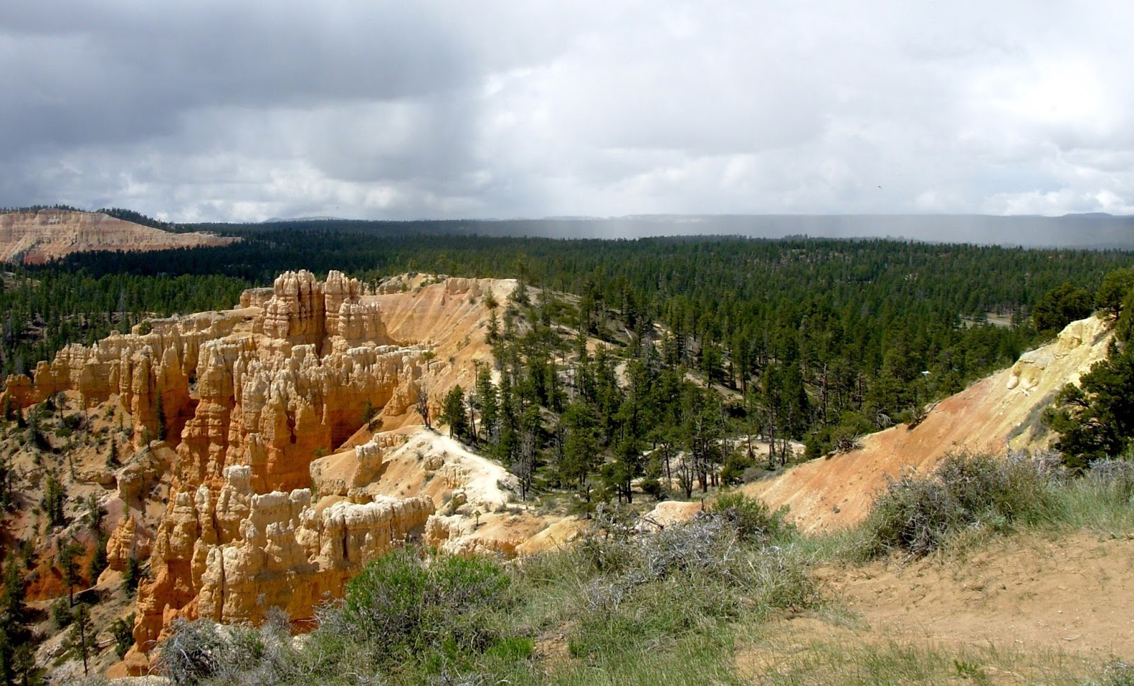
darker at Bryce Canyon and the full moon is brighter. In this high
elevation, the thin dry desert air is conducive to sunburn and moon
blindness. Last night while showing people the nearly full moon
through my telescope (using a polarizing filter at its darkest
setting), I looked back along the line and perhaps 80% of them had
their hands or a hat held up to the side of their face to block the
moonlight. As each stepped up to the eyepiece, I did my best to cast
a shadow over their faces as they observed.
Though the full
moon is the bane of every deep sky observer, I quite enjoyed showing
it off. The prominent ray crater Tycho appeared in full bloom—its
striking splatters reaching far across the surface, bisecting dark
Maria and bright Highlands alike. People's eyes were very naturally
drawn to Aristarchus—a brilliant white crater sharply contrasted
against the Ocean of Storms—and Grimaldi—a deep gray crater set
apart from the larger seas by a swath of highlands. More astute
observers enjoyed the shadowy terrain approaching the moon's
southernmost edge—the only place that betrayed any sense of depth
and topography.
Tonight I'll be
leaving the telescope at home to shadow Geoff's full moon hike. One
of the most popular programs here at Bryce, these limited Ranger led
excursions fill up less than an hour after the visitor center opens
in the morning. I'm excited to go wandering below the rim to see how
the hoodoos are transformed in the silvery moonlight. Some kind of
magic is inevitable!
Saturday June 14
Met up with an old
friend for breakfast yesterday morning. Chris (a violist in the Utah
Symphony as well as an artist), and I had exchanged a series of art
postcards years ago. It was nice to catch up and discuss a few of our
recent adventures.
In the afternoon, I
quietly barricaded myself in my room, put on some music, and DREW for
the first time since I've been here. To a soundtrack of Terry Riley
(“A Rainbow in Curved Air,” and “Poppy Nogood and the Phantom
Band”), John Adams (“The Wound Dresser,” Christian Zeal and
Activity,” “Five Songs by Charles Ives,” and “Eros Piano”),
and Sibelius (Symphony #5 and #7), I drew an imagined recollection of
an old crescent moon just before sunrise above the varnished cliffs
at Calf Creek. It felt FANTASTIC to draw again. I think I've been
needing a creative outlet. Though it's just a sketch—done using
ball point pen and a touch of pencil—I may decide to do a more
polished version when I get home.

The full moon hike
was every bit worth the hype. I was assigned to be the Caboose to
Geoff's group of 30—bringing up the rear and making sure no one got
left behind. On full moon hike nights, a couple telescopes are also
set up on the rim so people can view the moon and other bright
objects up close when they come back out of the amphitheater. Radar
and I grabbed a couple armloads and helped Richard get all his
equipment up the hill. It's hard to imagine a more stunning observing
platform.

At the beginning of
the hike Geoff led the crowd up to a nice spot on the rim near
Sunrise Point, gave some safety information, and introduced the focus
of his talk—the “superpowers” of Bryce Canyon's nighttime
plants and animals. And yes, plants DO have super powers. The Bronze
Evening Primrose produces a flower that blooms on only one night. In
order to ensure pollination, it virtually glows in ultraviolet and
lures in giant moths with a pungent odor. Bats pursue insects
(including the giant moth's) using sophisticated sonar. Glow
worms—females of a particular species of beetle—light up the back
segments of their bodies to help attract mates. Rattlesnakes see in
infrared. Great horned owls crush their prey with hundreds of pounds
of force in their powerful clutches. And the list goes on. A
fascinating topic. I wish I'd been taking notes to help remember more
of the specifics.
But before he got
in to all of that. Geoff finished his introduction with a dramatic
proclamation. “Ladies and Gentlemen...on behalf of the National
Park Service...I give you...the Full Moon!” At that moment a bead
of crimson broke the horizon over the distant landscape. Oohs and
ahhs broke out among the guests as people scrambled for their cameras
and the best vantage from which to capture the rapidly rising disc. A
windy day had stirred up a lot of dust, and this “Strawberry Moon”
was very dark ruddy orange. A spectacular sight above the painted
geometries of the high desert.
We continued along
the rim for a while and then headed down below on the Fairyland Loop
trail toward Tower Bridge, stopping periodically to take note of a
particular organism's “superpower” and enjoy Geoff's engaging
storytelling. The sky got darker and darker, and the trail along with
it. The moon was now behind a ridge and I found myself struggling a
bit to place each step securely.
It was right around
this time that Geoff started talking about Mountain Lions. They hunt
by staking out a heavily used game trail, climbing high up on a
nearby ridge, and then pouncing as deer amble by. But they won't go
for the first deer in the group. They'll instead wait till a slower one...maybe
sick or injured...comes by in the very back of the line, and then go straight for the neck. You can imagine how that made me feel as
the designated caboose! When it's made a kill, a lion will drag the
carcass high up into a tree. Then for several days it'll eat,
guarding it's stash from other scavengers who may try to score an
easy meal. A few years ago some visitors went to the rim early in the
morning and were horrified to discover a deer hanging high above them
in the branches of a tree. They immediately complained saying it was
a most cruel and tasteless practical joke. But it was no joke. A crew
of wildlife specialists and law enforcement officers armed to the
hilt were immediately sent to the scene. A lion kill so near to the
park's most heavily trafficked area posed a serious threat to
public safety. The deer was removed to a more remote location. A near
tragedy averted.
We continued down
the trail and finally into the moonlight. Stars were coming out now,
and the hoodoos appeared as immense black silhouettes against the
bluish night sky. As we approached the “Hoodoo Graveyard,”
moonlight struck the great white limestone walls like a spotlight,
casting sharp cool shadows, and encouraging the imagination to
conjure up a whole host fantastical creatures. Geoff told us of
nights he's travelled out to this spot with starlight alone to guide
his path—the grand arch of the Milky Way sweeping overhead—bright
enough to cast shadows of its own. Even in the full moon light, the
sky was full of stars fainter than I'd have guessed. Is that the
Milky Way? Or am I just imagining it. Nah...this time it's
imagination...I think.
Sunday June 15
Thanks to Dad, Carol, Mal, Ryan, Cid, Zoey, Todd, Yumi, Aaron, Ardis, Joel, Crystal, Robyn, and all the kids for visiting me at Bryce Canyon (and buying me ice cream:) It was great to see you all...even for just a few minutes.
AND HAPPY FATHER'S DAY DAD!
Tuesday June 17
So much has
happened. Too many details to be thorough. Some of the specifics meld
into what has become a sort of routine—though in a place like this
I hate to use such a word. It's the kind of routine where discovery
is the norm. Where I increasingly admire the skill of those with whom
I work, and from whom I hope I am learning a trick or two. Where the
same places visited day after day never lack for enchantment. A wild
Iris on the walk into work distracts my eye so that I almost fail to
notice a mother and two baby pronghorns grazing in the morning
shadows beneath the pines. I freeze to watch. She stamps her feet and
eyes me with a resolve I pray won't lead to a defensive charge.
Mother and babies: a lovely...nervous kind of sight I don't know
whether to relish or cautiously avoid.

The work comes with
its own set of challenges. I make mistakes. Deal with awkwardness and
tension here and there. Remind myself (with mixed success) not to
complain about trivialities. Take deep breaths. Call Rob for a kind
word and a loving ear. Forgive myself for things I could've done
better...and then try to do them better next time. Remember to let
things come as they may. Take a break now and then.
Yesterday I visited
“Spooky” and “Peekaboo,” two slot canyons in the Grand
Staircase with Don, one of the Interpretive Rangers here. We stopped
in at the Escalante Visitor Center—interesting being on the other
side of the desk after weeks of playing informal tour guide—to
check on road conditions, hiking maps, and trail information. The
Ranger said getting up to Peekaboo would require a moderately
technical scramble up about 10 feet of sandstone. The directions I'd
read online that morning said it would be more like 20 feet. Sucking
in my old nervousness of heights, I pressed for more details. She
said we'd have to help each other through a few tough scrambles, but
that no ropes would be needed. Don and I were not well acquainted,
but I imagined we could muddle through well enough together.
Don is good company. On the surface it seems we both tend
toward a quieter approach to interaction. Politely inquisitive.
Casually interested without ulterior pressures or motivations. I
appreciated being able to probe his deeper knowledge of the area.
Glad a more experienced professional would allow me to tag along for
a little adventure.
The “Dry Fork
Slots,” are located about 27 miles south along the Hole-in-the-Rock
Road. It was heavily washboarded and high-clearance vehicles were
strongly recommended. I was grateful Don had agreed to drive us in
his pickup. A few miles in we made a brief stop at the “Devil's
Garden” to wander among a different kind of hoodoo (and take a
final bathroom break). Comparatively low to the ground and
voluptuously smooth, these wind-carved sandstone hoodoos were an
interesting contrast to the towering, brittle, and multi-faceted,
rock gardens of Bryce Canyon I've been familiar with of late.

The last stretch of
road leading to Dry Fork looked as though it was molded from mounds
of clay. All guides state emphatically that the route is impassible
after even the slightest rain. On a map, several roads lead south
from highway 12 through the Grand Staircase—Hole-in-the-Rock,
Cottonwood, Alvey Wash, Smokey Mountain—and look to many visitors
like excellent alternative routes to highway 89 south toward Page.
Seeing the conditions of these roads firsthand brought home the
warnings I'd heard from other Bryce volunteers that one should ALWAYS
check in at the GSENM visitor center before using them for travel.
Scenic? Yes. Practical? No.
Once parked, we
followed a series of large, widely-spaced cairns down a steep
slick-rock outcrop. This “trail” leads down to a broad sandy wash
into which Dry Fork, Peekaboo, and Spooky canyons empty. Dry Fork is
a section of “narrows” (a little wider than a “slot,” but not
by much), that can be followed for several miles. Maybe we would
check it out on our way back. The entrance to Peekaboo was nearby to
the left where a small group of people was clustered about its mouth.
A young family who'd just come down its length watched excitedly as a
number of twenty-somethings prepared to ascend.

I looked up at the
smooth sculptured sandstone with a bit of trepidation. A series of
shallow hand and toe holds were carved into its surface. It was definitely more than 10 feet of climbing. I motioned to Don to go
first, hoping to observe his technique. The first bit seemed fine
enough. A stone ladder—a quick pivot over a thin vertical
ledge—then a gradual chute where a little wedging between hips and
feet would carry you up. Don struggled a little, but seemed
relatively unfazed by the awkward motions. A knot had built up in the
pit of my stomach, but, I thought, if a 67 year old man could manage
it,- there's no reason I shouldn't be able to. Right?
A tall energetic
German youth arrived suddenly, and virtually leapt up the whole way,
stepping right over the top of Don who was just completing the last
bit of his ascent. His girlfriend stopped beside me. “He's a real
mountain goat!” she said. The German held out a hand to Don and
helped him up the rest of the way. He then tossed a rope down to his
girlfriend and offered to hoist up both our packs. “It will make it
easier to balance,” he encouraged. I gulped and clipped on my pack.
It was my turn.
I cautiously
stepped up the pile of stones leading to the first toe hold. A little
wobbly for my taste. One step. Hmm. Wrong foot. Step down. Switch
feet. Start with the left this time. Umm. Still not so comfortable.
It looked so easy for the others. Right foot it is then. Ok. Left.
Sort of. Hold on. Pull up. Sit down. Ok! Two thirds to go. Take a
breath. Now how to manage that pivot. I wish there wasn't so much
sand in these toe holds. 6 feet looks a lot taller from up here. Lean
into the rock. Swing my body around. Ok, sit! It's so slick! Can't
seem to make the wedging work. There's nothing to hold onto. My feet
just want to slide. No traction. I can feel the pull of gravity. Not
sure where to hold. The smallest shift of weight could send me
sliding down to the ground. The German can see my fear and throws me
the rope. It's such a thin little thing. Just a string. Holding onto
it gives me no assurance. Their hands are only a couple feet from my
grasp, but I can't seem to push myself higher. Mom and kids are
watching below. “You can do it. Just a little bit higher!” But my
legs are shaking now. I can feel my broken bones below. Hear the
sound. A dull crack.
“I'm going to
make a decision for my own safety. I'm not sure enough on my feet. I
should head down.”
“I don't accept that!” insisted the German.
“You can do it.”
“I've got to be
honest about my ability. If I'm struggling here, it will be worse
further up.”
A wave of
disappointment.
I resolve to
indulge in minimum apology. I won't wallow. This is a practical
safety decision. I have to understand and accept the limits of my
ability.
With guidance from
Mom and kids below, I shakily make my way back down the stone ladder.
The German girlfriend takes her turn. Struggles a little, but slowly
makes it up. They send down my pack. Don descends. I'm embarrassed,
but feel I've made the right decision. I make my apologies, say thank
you and good luck to Mom and kids and the German couple. I'm grateful
Don seems to be easy going enough to not be too put off by my backing
down. “There was a real danger there,” he says
reassuringly.
We walk along the
sandy edges of the giant mound of rock from which Peekaboo was
formed. Climbing slowly now—one step forward, half a step back in
the hot slippery sand—we eventually top the sandstone bulge and
begin to explore. Cairns! An alternate route around the canyon
perhaps? Soon we are looking down into the narrowly winding,
knife-edged slot. It's an easy descent to the bottom from here...
...and
now I hear voices! Our German friends are squeezing their way through
the sculpted zig-zags. “What took you so long?!” I say.
They don't have a
map so we share ours, along with the directions for finding Spooky
from the upper exit of Peekaboo. Now it's our turn to descend into
the zig zag. It's hard to believe that an adult human body is capable
of gliding through the contortions of sharp-edged sandstone that lead
us deeper into the canyon. We take off our packs and bend, slide,
bump, and lean through the one-way maze.
As the walls rise around us,
I imagine a flash flood sweeping through—filling the canyon to its
top and rushing over its edges—the water thick with sand and broken
bits of brush. We reach a point where Don judges the descent a little
too steep—a hoop of rock showing a sandy bottom many feet below—
and then head back up the way we came. Here and there I give him a
push up from behind, and he offers a hand up in return.
Back down in Dry
Fork Wash, we head toward the entrance to Spooky. Temperatures are
mercifully mild, but a fierce wind whips up billows of sand that make
my teeth grate like sandpaper. The gale is desiccating. I can almost
feel the moisture wicked from beneath my skin. What would it be like
to travel across this landscape with limited provisions? What must
those early pioneers have endured along their journey south to
Hole-in-the-Rock—a passage they had to carve out themselves to
enable travel by wagon team? 1880. That's not all that long ago. My
grandparents would have been old enough to have spoken with someone who made the trip.


Spooky's entrance
is much more inviting—sort of. There's no steep climb. The trail
remains level as you enter this slot. But the high walls close in
rapidly. Packs must be removed, and travel through the canyon is only
possible sideways. Our chests and bellies slide over bumpy sandstone
conglomerate. “This is the slottiest canyon I think I've ever been
in,” quipped Don. Shadows are deep and hues of reflected light cast
an eerie glow over the rock. Spooky indeed!
...and not ideal for hand-held photography as you can see from the blurry pictures...just think of them as action shots!
Voices ahead. Our German
friends once again. We hurry to a slightly wider cutout in the rock
and allow the couple to pass. Smiles all around. Continuing on
there's a hint of...music? We meet a photographer with tripod set for
a long exposure, earbuds in, no doubt preparing to take a classic
shot of light cascading over elegant sandstone curves.

I honestly never
thought I'd actually be able to see one of these picture-postcard
desert-calendar slot canyons in person. I'd always assumed that the
photos I'd seen were captured in secret corners of wilderness shared
only among elite climbers, adventurers...people infinitely more
well-equipped and more in-the-know than little old me. But I am
actually here. Feeling the rough stone scrape my skin. Willfully
trapped within a world of pale light, rich shadow, and fanciful
geometry, lit by nothing more than a thin line of deep blue overhead.
Looking way up we see huge boulders suspended in mid fall. Wedged
between the canyon walls, piles of plant debris has collected around
each point of contact—a sobering reminder of the violent floods
whose currents carved out this channel just wide enough for a
medium-sized adult to navigate.

Finally we reached
a point where further squeezing might have caused torn shirts and
uncomfortable scrapes. I can't say we turned around—there wasn't
room for that—we just reversed our sideways shimmy and headed out
the way we came.

The climb up was
hot, sandy, sunbaked, guesswork. I downed the last of my water, happy
knowing I had a third full bottle back in the truck. At one point we
lost the trail of cairns, so just kept climbing till we reached the
top of the hill and could see the parking lot in the distance.
Stepping gingerly so as to avoid the fragile cryptobiotic soil
growing all around us, we made it back. My water was hot enough to
brew tea and tasted like plastic, but who's complaining? After
another noisy bumpy drive up the road, we rewarded ourselves with
cold drinks and pizza at
Escalante Outfitters, and relaxed to an
old tape recording of “The Hobbit” on our way home. In spite of
my embarrassing bout of acrophobia, it turned out to be a very
enjoyable and rejuvenating day. Thanks Don for the idea and the
invitation!