I went on another mega-hike yesterday, this time to Lathrop Canyon: a 13.6 mile out-and-back trip to the White Rim...which means, of course that there are also 1,400 feet of elevation involved...it's a given. If there'd been a few more hours in the day, I might have tacked on a quick round trip to the Colorado River as well. There's a mountain bike trail that takes off from the bottom of Lathrop and would've added 8 miles and 600 feet. I had an abundance of energy yesterday and was itching to go, but sun sets at 5:00 these days, and the thought of searching for cairns in the dark brought me back to my senses. The hike I took was enough. Challenging, ever so slightly terrifying (I've still got occasional issues with steep drop offs...especially when descending), and stunningly gorgeous. Treasures for the eyes on a large scale...

...and on a small one.

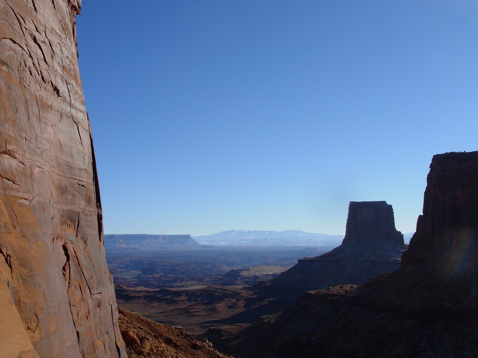
Here I stopped to BEG that these precarious sandstone pillars would stay standing for...at least a few more hours. (Check out the waning moon at bottom left)

I'm starting to become acquainted with the pacing of these hikes below the rim. Every rock layer has a character. There's a particular feel to descending the imposing Wingate cliffs by picking my way down a boulder field of Wingate, and Kayenta, and maybe a little Navajo Sandstone thrown in for good measure.

There's the trail...see it? Yeah...me neither. It descends from the upper right of this photo and eventually straight down the middle in a tight series of switchbacks. I moved very slowly in this section. Cairn to cairn. Lots of sliding on my butt.

Then there's the slightly more gentle Chinle, and (maybe my favorite) the chocolate-peanut-butter-ice-cream-layer cake of the Moenkopi.

And then I'm at the bottom--and its smooth sailing and lovely views all the way to the White Rim.

Here's where the mountain bike trail continues on to the Colorado...a journey for another day.

For now, there's lunch!

And then it's back up those cliffs.

I love how much things are different on the way back. Even though it's the very same trail--I can even follow my own footprints--by the time I head up after an all-day hike, the light has changed, the shadows have changed, I approach little nooks and crannies from a new angle and find old mining equipment...

The hoofprints I followed on the way down...

...reveal their creators on the way up. (Woo hoo! The first time I've EVER seen bighorns in the wild:)

And the evening light falling over this maze of canyons--there's just no good way to describe it.
Check out the reflections on that bend in the Colorado...

Up...and up...and up...

And then looking down on my lunch spot. Right at that tip of that little canyon so far below.

The colors of the Navajo Sandstone come alive in the evening light. And check out this crazy bush! It's angled perfectly to collect the most light it can in that one spot--roots and branches totally bare on the back side--flat as a pancake.

Here comes Peter Cottontail...

Hoppin' down the bunny trail...looks like bunnies follow cairns too.

And to cap it all off, the last mile of the trail crosses a big open grassland, punctuated by little bluffs and buttes, and just as I was coming up on my car, I heard the trilling wails of a flock of migrating cranes. A little V of them circled around a bit--maybe catching their bearings, maybe gaining altitude--and then they took off to the south east--straight toward New Mexico.


